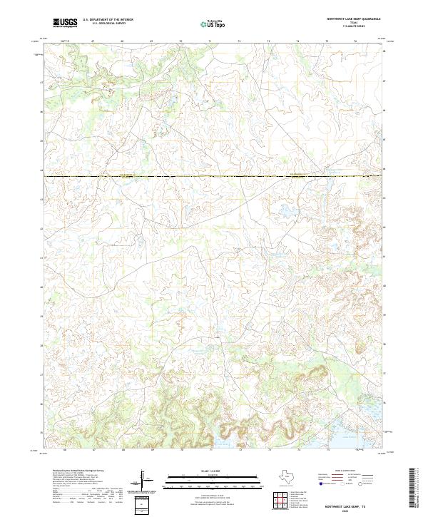
2022 Map of Northwest Lake Kemp
USGS Topo · Published 2022About this map
The rolling plains of North Texas are defined here by the extensive drainage systems feeding into the Lake Kemp reservoir system. Spanning the county line between Wilbarger Co and Baylor Co, the landscape is dominated by a network of ranch-land impoundments known as the Waggoner Lakes. These features, including Waggoner Lake Number 1, Waggoner Lake Number 2, and Waggoner Lake Number 4, indicate a highly managed water landscape typical of large-scale Texas cattle operations. Significant creek systems such as Beaver Cr, Indian Cr, and Buck Cr carve through the terrain, illustrating the natural watershed that sustains this region. The presence of Lost Lake and Fish Cr further highlights the area's hydrology, which is central to the local geography and ranching heritage of these two historic counties.
Find a feature on this map
13 named features on this map. Tap any name to fly to it.
Don’t see what you’re looking for? This feature index may not catch every label — zoom into the map to look around manually.
Map Details
Editions of this 2022 Northwest Lake Kemp Map
This is the sole edition of this map. No revisions or reprints were ever made.
Other maps of this area

1954 · Wichita Falls
USGS Topo · 1:250,000

1958 · Wichita Falls
USGS Topo · 1:250,000

1966 · Santa Rosa Lake
USGS Topo · 1:24,000

1966 · Santa Rosa Lake SW
USGS Topo · 1:24,000

1966 · Grayback
USGS Topo · 1:24,000

1966 · Soap Creek
USGS Topo · 1:24,000

1966 · Northeast Lake Kemp
USGS Topo · 1:24,000

1966 · Southeast Lake Kemp
USGS Topo · 1:24,000

1966 · Northwest Lake Kemp
USGS Topo · 1:24,000

1966 · Southwest Lake Kemp
USGS Topo · 1:24,000