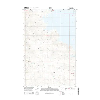
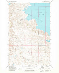
2014 Map of Norville Creek
USGS Topo · Published 2014About this map
Haxby serves as the primary point of interest in this Garfield County landscape, situated just south of the expansive waters of Fort Peck Lake. The geography is defined by a complex network of drainages and coulees, where Norville Cr and Dawson Cr flow eastward toward the reservoir. To the south, the terrain transitions into the valleys of Sage Cr and N Fork Box Cr. This 2014 survey captures the intricate shoreline and surrounding ranchlands as they exist today, documenting the rugged drainage patterns of Cut Coulee and Spring Draw. The map provides essential detail for understanding the modern hydrology and land divisions in this part of Montana, reflecting the intersection of major water management projects and traditional prairie settlements.
Find a feature on this map
14 named features on this map. Tap any name to fly to it.
Don’t see what you’re looking for? This feature index may not catch every label — zoom into the map to look around manually.
Map Details
Editions of this 2014 Norville Creek Map
This is the sole edition of this map. No revisions or reprints were ever made.
Other maps of this area

1954 · Jordan
USGS Topo · 1:250,000

1956 · Jordan
USGS Topo · 1:250,000

1958 · Jordan
USGS Topo · 1:250,000

1958 · Sage Creek Point
USGS Topo · 1:24,000
1958 · Skunk Coulee
USGS Topo · 1:24,000

1964 · Jordan
USGS Topo · 1:250,000
1972 · Spring Creek Bay
USGS Topo · 1:24,000
1972 · Gilbert Creek
USGS Topo · 1:24,000
1972 · Norville Creek
USGS Topo · 1:24,000

1972 · Ash Creek East
USGS Topo · 1:24,000