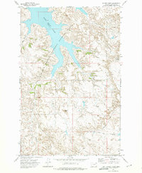
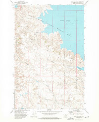
1972 Map of Gilbert Creek
USGS Topo · Published 1975About this map
The northern reaches of the Charles M Russell National Wildlife Range define this 1970s landscape, where the waters of Fort Peck Lake fill the complex coulees of the Missouri River country. The map captures a rugged topography marked by prominent landmarks such as Square Butte and Brownie Butte, which rise above the dissected breaks. The drainage network is intricately mapped, showing the courses of Gilbert Creek and East Gilbert Creek as they flow toward the reservoir.
Find a feature on this map
12 named features on this map. Tap any name to fly to it.
Don’t see what you’re looking for? This feature index may not catch every label — zoom into the map to look around manually.
Map Details
Editions of this 1972 Gilbert Creek Map
This is the sole edition of this map. No revisions or reprints were ever made.
Other maps of this area

1954 · Jordan
USGS Topo · 1:250,000

1956 · Jordan
USGS Topo · 1:250,000

1958 · Jordan
USGS Topo · 1:250,000

1958 · Sage Creek Point
USGS Topo · 1:24,000
1958 · Seventh Point Buttes
USGS Topo · 1:24,000

1964 · Jordan
USGS Topo · 1:250,000
1972 · Kester School
USGS Topo · 1:24,000
1972 · Gilbert Creek SE
USGS Topo · 1:24,000

1972 · Flat Creek School
USGS Topo · 1:24,000
1972 · Norville Creek
USGS Topo · 1:24,000