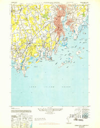
1943 Map of Norwalk South
USGS Topo · Published 1947About this map
The coastal communities of Norwalk and Darien are captured in this 1943 survey, revealing the dense residential and industrial patterns of the mid-century Connecticut shore. The red-tinted urban cores of South Norwalk and East Norwalk stand in contrast to the wooded estates of Tokeneke Park and the greenhouses scattered near Rowayton. The intricate shoreline of Long Island Sound is a primary focus, featuring a vast archipelago that includes Sheffield Island, Chimon Island, and Cockenoe Island.
Find a feature on this map
83 named features on this map. Tap any name to fly to it.
Don’t see what you’re looking for? This feature index may not catch every label — zoom into the map to look around manually.
Map Details
Editions of this 1943 Norwalk South Map
This is the sole edition of this map. No revisions or reprints were ever made.
Other maps of this area

1892 · Stamford
USGS Topo · 1:62,500

1892 · Norwalk
USGS Topo · 1:62,500

1893 · Stamford
USGS Topo · 1:62,500

1893 · Norwalk
USGS Topo · 1:62,500

1897 · Oyster Bay
USGS Topo · 1:62,500

1898 · Oyster Bay
USGS Topo · 1:62,500

1899 · Stamford
USGS Topo · 1:62,500

1900 · Oyster Bay
USGS Topo · 1:62,500

1901 · Northport
USGS Topo · 1:62,500

1903 · Northport
USGS Topo · 1:62,500