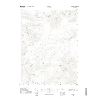
2019 Map of Norwich
USGS Topo · Published 2019About this map
Deep ravines and narrow valleys define the landscape of McKean County, where E Br Potato Cr and its many tributaries carve through the plateau. The terrain is marked by dozens of named hollows, such as Tramroad Hollow and Stone Chimney Hollow, indicating a history of resource extraction and local place-naming. High points like Evans Hill and Jay Cox Hill rise above the drainage network of Railroad Run and Scaffold Lick Run. The presence of roads like Scaffold Lick Rd and Colegrove Brk Rd following these watercourses suggests a persistent pattern of navigating the area's difficult topography. The sheer density of named features like Keesler Hollow and Porcupine Hollow reflects a detailed local geography used by generations of residents in Liberty Township.
Find a feature on this map
49 named features on this map. Tap any name to fly to it.
Don’t see what you’re looking for? This feature index may not catch every label — zoom into the map to look around manually.
Map Details
Editions of this 2019 Norwich Map
This is the sole edition of this map. No revisions or reprints were ever made.
Other maps of this area

1933 · Smethport
USGS Topo · 1:62,500

1934 · Coudersport
USGS Topo · 1:48,000

1937 · Smethport
USGS Topo · 1:62,500

1938 · Coudersport
USGS Topo · 1:62,500

1948 · Crosby
USGS Topo · 1:62,500

1948 · Emporium
USGS Topo · 1:62,500

1948 · Keating Summit
USGS Topo · 1:24,000

1948 · Emporium
USGS Topo · 1:24,000

1948 · Wildwood Fire Tower
USGS Topo · 1:24,000

1948 · Rich Valley
USGS Topo · 1:24,000