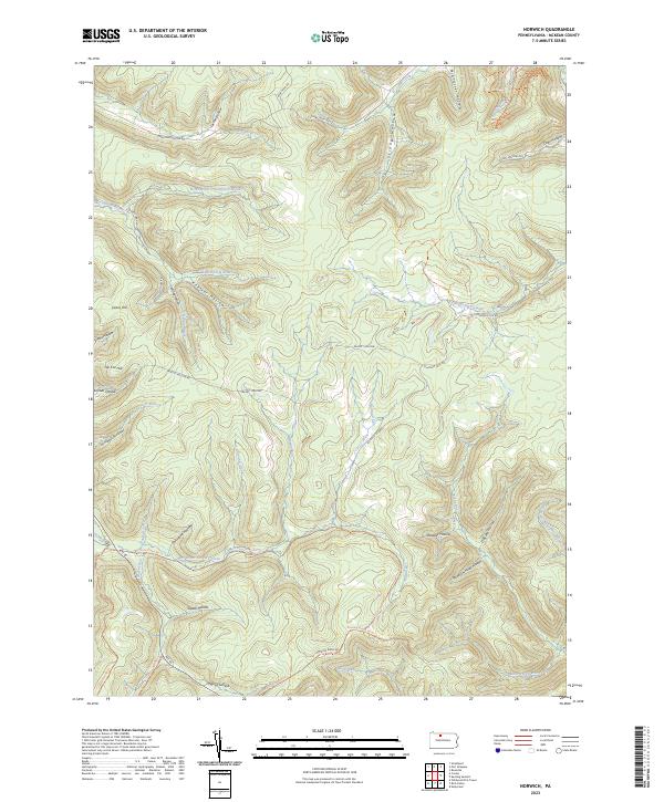
2023 Map of Norwich
USGS Topo · Published 2023About this map
High elevations in the Allegheny Plateau define this section of McKean County, where East Branch Potato Creek and its many tributaries carve a network of deep hollows. The terrain is characterized by prominent rises such as Evans Hill and Jay Cox Hill, which overlook a landscape dominated by timber and natural resources. This 2023 survey illustrates the modern road network, including Rte 46 and numerous forest tracks like Scaffold Lick Rd and Dividing Ridge Rd. Names like Stone Chimney Hollow and Keesler Hollow suggest a history of early settlement and resource extraction, while Lyman Run and Scaffold Lick Run drain the complex ridgelines. The map provides a contemporary view of the topography, showing how historical paths and watercourses continue to shape movement through this part of Pennsylvania.
Find a feature on this map
51 named features on this map. Tap any name to fly to it.
Don’t see what you’re looking for? This feature index may not catch every label — zoom into the map to look around manually.
Map Details
Editions of this 2023 Norwich Map
This is the sole edition of this map. No revisions or reprints were ever made.
Other maps of this area

1933 · Smethport
USGS Topo · 1:62,500

1934 · Coudersport
USGS Topo · 1:48,000

1937 · Smethport
USGS Topo · 1:62,500

1938 · Coudersport
USGS Topo · 1:62,500

1948 · Crosby
USGS Topo · 1:62,500

1948 · Emporium
USGS Topo · 1:62,500

1948 · Keating Summit
USGS Topo · 1:24,000

1948 · Emporium
USGS Topo · 1:24,000

1948 · Wildwood Fire Tower
USGS Topo · 1:24,000

1948 · Rich Valley
USGS Topo · 1:24,000