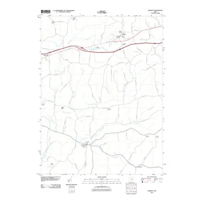
2010 Map of Norwich
USGS Topo · Published 2010About this map
Norwich and Chandlersville anchor this Muskingum County landscape, where deep-rooted agrarian patterns meet modern infrastructure. The map documents a geography defined by the branching waters of Salt Creek and Williams Fork, which have long shaped local commerce and travel. Traces of early industrial activity are visible at Smith Mill, while numerous burial grounds, including Norwich Methodist Cemetery and Rock Spring Cemetery, provide critical reference points for genealogical research. The survey captures the corridor of the modern highway system passing through Sundale and Bridgeville, contrasting with the winding paths of Zane Trace Rd and Clay Pike. These old roads follow the ridges and valleys of the eastern Ohio plateau, connecting outlying features like Coon Ridge and the Bakers Pond Dam to the established settlements.
Find a feature on this map
78 named features on this map. Tap any name to fly to it.
Don’t see what you’re looking for? This feature index may not catch every label — zoom into the map to look around manually.
Map Details
Editions of this 2010 Norwich Map
This is the sole edition of this map. No revisions or reprints were ever made.
Other maps of this area

1908 · Conesville
USGS Topo · 1:62,500

1909 · Cambridge
USGS Topo · 1:62,500

1910 · Philo
USGS Topo · 1:62,500

1910 · Conesville
USGS Topo · 1:62,500

1911 · Cumberland
USGS Topo · 1:62,500

1912 · Cambridge
USGS Topo · 1:62,500

1949 · Clarksburg
USGS Topo · 1:250,000

1951 · Canton
USGS Topo · 1:250,000

1953 · Canton
USGS Topo · 1:250,000

1956 · Clarksburg
USGS Topo · 1:250,000