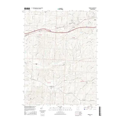
2016 Map of Norwich
USGS Topo · Published 2016About this map
Norwich and the neighboring village of New Concord anchor the northern landscape of this Muskingum County study. The terrain is deeply carved by the headwaters of several drainage systems, including Salt Cr, White Eyes Cr, and the branches of Williams Fork and Buffalo Fork. This intricate topography influenced the placement of early settlements like Chandlersville and Freeland, which sit along the winding rural corridors of the south. Evidence of the area's pioneer heritage and genealogy is preserved through numerous burial grounds, such as Salt Creek Cem and Rock Spring Cem. Local commerce and early industry are reflected in features like Smith Mill and the crossroads at Sundale. The map illustrates how transportation routes, from the modern interstate to historic paths like East Pike, have adapted to the ridge-and-valley structure of the Appalachian Plateau, connecting these small farming and residential communities.
Find a feature on this map
143 named features on this map. Tap any name to fly to it.
Don’t see what you’re looking for? This feature index may not catch every label — zoom into the map to look around manually.
Map Details
Editions of this 2016 Norwich Map
This is the sole edition of this map. No revisions or reprints were ever made.
Other maps of this area

1908 · Conesville
USGS Topo · 1:62,500

1909 · Cambridge
USGS Topo · 1:62,500

1910 · Philo
USGS Topo · 1:62,500

1910 · Conesville
USGS Topo · 1:62,500

1911 · Cumberland
USGS Topo · 1:62,500

1912 · Cambridge
USGS Topo · 1:62,500

1949 · Clarksburg
USGS Topo · 1:250,000

1951 · Canton
USGS Topo · 1:250,000

1953 · Canton
USGS Topo · 1:250,000

1956 · Clarksburg
USGS Topo · 1:250,000