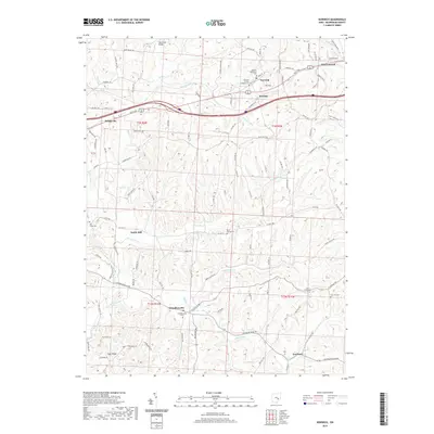
2019 Map of Norwich
USGS Topo · Published 2019About this map
Norwich sits along the northern corridor of this Muskingum County landscape, where Interstate 70 and East Pike cut through the terrain. The map captures a transition from the denser cluster of New Concord to the smaller crossroads of Bridgeville and Sundale. This region is defined by its numerous small-scale drainage systems, including White Eyes Cr, Georges Run, and Frog Run, which carve through the land between agricultural plots and wooded ridges.
Find a feature on this map
116 named features on this map. Tap any name to fly to it.
Don’t see what you’re looking for? This feature index may not catch every label — zoom into the map to look around manually.
Map Details
Editions of this 2019 Norwich Map
This is the sole edition of this map. No revisions or reprints were ever made.
Other maps of this area

1908 · Conesville
USGS Topo · 1:62,500

1909 · Cambridge
USGS Topo · 1:62,500

1910 · Philo
USGS Topo · 1:62,500

1910 · Conesville
USGS Topo · 1:62,500

1911 · Cumberland
USGS Topo · 1:62,500

1912 · Cambridge
USGS Topo · 1:62,500

1949 · Clarksburg
USGS Topo · 1:250,000

1951 · Canton
USGS Topo · 1:250,000

1953 · Canton
USGS Topo · 1:250,000

1956 · Clarksburg
USGS Topo · 1:250,000