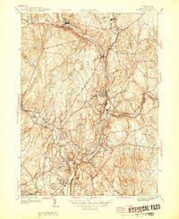
1945 Map of Norwich
USGS Topo · Published 1945About this map
The Shetucket River and Quinebaug River converge in this mid-1940s landscape, shaping the industrial and residential core of Norwich. The river valley acts as a corridor for the New York New Haven and Hartford RR, connecting mill towns and settlements like Taftville, Occum, and Versailles. The map's detail is particularly rich in its documentation of local institutions, from the Free Academy and Elizabeth St Sch to the sprawling State Sanitarium and Lisbon Country Club. While the city center is shown with landmark buildings, the surrounding hills such as Plain Hill and Ox Hill are dotted with reservoirs and smaller hamlets like Norwichtown and Yantic. These features illustrate the transition from a dense river-powered manufacturing center to the more open, agricultural highlands of Lisbon and Sprague.
Find a feature on this map
61 named features on this map. Tap any name to fly to it.
Don’t see what you’re looking for? This feature index may not catch every label — zoom into the map to look around manually.
Map Details
Editions of this 1945 Norwich Map
This is the sole edition of this map. No revisions or reprints were ever made.
Other maps of this area

1889 · Stonington
USGS Topo · 1:62,500

1889 · Moosup
USGS Topo · 1:62,500

1892 · New London
USGS Topo · 1:62,500

1892 · Norwich
USGS Topo · 1:62,500

1893 · Moosup
USGS Topo · 1:62,500

1893 · Stonington
USGS Topo · 1:62,500

1893 · New London
USGS Topo · 1:62,500

1920 · Moosup
USGS Topo · 1:62,500

1921 · New London
USGS Topo · 1:62,500

1921 · Stonington
USGS Topo · 1:62,500