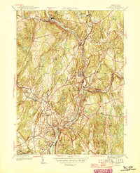
1946 Map of Norwich
USGS Topo · Published 1946About this map
Norwich and the surrounding industrial valleys of the Shetucket River and Quinebaug River define this post-war New London County landscape. The convergence of these waters into the Thames River anchors a region built on textile and paper production, evidenced by numerous mill ponds like Paper Mill Pond and the extensive workers' housing in Taftville and Occum. The map reveals a dense network of civic and educational infrastructure, from the Free Academy to several neighborhood schools such as Bishop Sch and Smith Ave Sch.
Find a feature on this map
68 named features on this map. Tap any name to fly to it.
Don’t see what you’re looking for? This feature index may not catch every label — zoom into the map to look around manually.
Map Details
Editions of this 1946 Norwich Map
This is the sole edition of this map. No revisions or reprints were ever made.
Other maps of this area

1889 · Stonington
USGS Topo · 1:62,500

1889 · Moosup
USGS Topo · 1:62,500

1892 · New London
USGS Topo · 1:62,500

1892 · Norwich
USGS Topo · 1:62,500

1893 · Moosup
USGS Topo · 1:62,500

1893 · Stonington
USGS Topo · 1:62,500

1893 · New London
USGS Topo · 1:62,500

1920 · Moosup
USGS Topo · 1:62,500

1921 · New London
USGS Topo · 1:62,500

1921 · Stonington
USGS Topo · 1:62,500