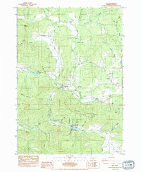
1984 Map of Noti
USGS Topo · Published 1984About this map
The Long Tom River meanders through a landscape defined by timber and transit in this mid-1980s study of western Lane County. The settlement of Noti serves as a central hub, situated where the Southern Pacific railroad and Route 126 intersect near the confluence of Noti Creek and the river. This area reflects a history of early pioneer settlement and industrial utility, evidenced by the Sailor Pioneer Cem and the presence of a Gaging Station and several quarries.
Find a feature on this map
60 named features on this map. Tap any name to fly to it.
Don’t see what you’re looking for? This feature index may not catch every label — zoom into the map to look around manually.
Map Details
Editions of this 1984 Noti Map
This is the sole edition of this map. No revisions or reprints were ever made.
Other maps of this area

1909 · Elmira
USGS Topo · 1:62,500

1922 · Elmira
USGS Topo · 1:62,500

1941 · Blachly
USGS Topo · 1:62,500

1942 · Elmira
USGS Topo · 1:62,500

1942 · Blachly
USGS Topo · 1:62,500

1942 · Crow
USGS Topo · 1:62,500

1942 · Roman Nose Mtn
USGS Topo · 1:62,500

1945 · Crow
USGS Topo · 1:62,500

1945 · Roman Nose Mtn
USGS Topo · 1:62,500

1953 · Salem
USGS Topo · 1:250,000