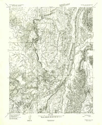
1954 Map of Notom 1 SE
USGS Topo · Published 1957About this map
The Fremont River carves through this desert landscape of Wayne County, Utah, providing a vital source of water for the agricultural works of the mid-1950s. The presence of the Caineville Ditch illustrates the early efforts to redirect river water for local irrigation, supporting life at the base of the massive North Caineville Mesa and South Caineville Mesa. These flat-topped landmarks dominate the eastern horizon, while a network of seasonal drainages such as North Blue Flats Wash, Dry Wash, and Sandy Creek define the complex erosion patterns across the basin. Near the southern edge, the convergence of Pleasant Creek with the river highlights the geographic features that guided early routes through this remote territory during the 1950s.
Find a feature on this map
8 named features on this map. Tap any name to fly to it.
Don’t see what you’re looking for? This feature index may not catch every label — zoom into the map to look around manually.
Map Details
Editions of this 1954 Notom 1 SE Map
This is the sole edition of this map. No revisions or reprints were ever made.
Other maps of this area

1885 · San Rafael
USGS Topo · 1:250,000

1885 · Fish Lake
USGS Topo · 1:250,000

1896 · Fish Lake
USGS Topo · 1:250,000

1952 · Notom 4 NW
USGS Topo · 1:24,000

1952 · Notom 4 NE
USGS Topo · 1:24,000

1952 · Notom 1 SW
USGS Topo · 1:24,000

1952 · Notom
USGS Topo · 1:62,500

1954 · Mt. Ellen 2 SW
USGS Topo · 1:24,000

1954 · Mt. Ellen 2 NW
USGS Topo · 1:24,000

1954 · Notom 1 NE
USGS Topo · 1:24,000