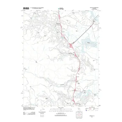
2012 Map of Novato
USGS Topo · Published 2012About this map
Novato serves as the central hub of this 2012 survey, revealing the complex suburban and tidal landscape of Marin County just after the turn of the millennium. The map documents the historic core of Old Town alongside expanding residential developments like Novato Heights and the waterfront community of Bel Marin Keys. Notable landmarks include the sprawling aviation history at Hamilton Field and local recreation points such as the Novato Horsemans Arena.
Find a feature on this map
140 named features on this map. Tap any name to fly to it.
Don’t see what you’re looking for? This feature index may not catch every label — zoom into the map to look around manually.
Map Details
Editions of this 2012 Novato Map
This is the sole edition of this map. No revisions or reprints were ever made.
Other maps of this area

1895 · San Francisco
USGS Topo · 1:62,500

1897 · Tamalpais
USGS Topo · 1:62,500

1899 · San Francisco
USGS Topo · 1:62,500

1902 · Napa
USGS Topo · 1:125,000

1914 · Petaluma
USGS Topo · 1:62,500

1915 · San Francisco
USGS Topo · 1:62,500

1916 · Mare Island
USGS Topo · 1:62,500

1941 · Tamalpais
USGS Topo · 1:62,500

1942 · Mare Island
USGS Topo · 1:62,500

1942 · Petaluma
USGS Topo · 1:62,500