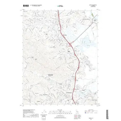
2018 Map of Novato
USGS Topo · Published 2018About this map
Novato and northern San Rafael anchor this detailed study of eastern Marin County, where the sprawling suburban developments of the late 20th century meet the tidal wetlands of the Petaluma River. The landscape is defined by the sharp contrast between concentrated residential communities like Terra Linda and Santa Venetia and the high, open terrain of Big Rock Ridge and Loma Alta. Waterways such as Novato Creek and Gallinas Creek wind through the valley floors, providing a natural framework for the region's growth.
Find a feature on this map
57 named features on this map. Tap any name to fly to it.
Don’t see what you’re looking for? This feature index may not catch every label — zoom into the map to look around manually.
Map Details
Editions of this 2018 Novato Map
This is the sole edition of this map. No revisions or reprints were ever made.
Other maps of this area

1895 · San Francisco
USGS Topo · 1:62,500

1897 · Tamalpais
USGS Topo · 1:62,500

1899 · San Francisco
USGS Topo · 1:62,500

1902 · Napa
USGS Topo · 1:125,000

1914 · Petaluma
USGS Topo · 1:62,500

1915 · San Francisco
USGS Topo · 1:62,500

1916 · Mare Island
USGS Topo · 1:62,500

1941 · Tamalpais
USGS Topo · 1:62,500

1942 · Mare Island
USGS Topo · 1:62,500

1942 · Petaluma
USGS Topo · 1:62,500