Loading...
Loading map...2021 Map of Novato
USGS Topo · Published 2021About this map
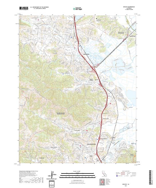
Novato serves as a central hub in this modern topography of northern Marin County, where the sprawling suburban landscape meets the bay lands and tidal marshes. To the east, the Petaluma River and Gallinas Creek carve through the lowlands, defining the edge of settlements like Black Point and Santa Venetia. The terrain is marked by significant elevations such as Big Rock Ridge and Pacheco Hill, which create natural boundaries between communities.
Find a feature on this map
55 named features on this map. Tap any name to fly to it.
Don’t see what you’re looking for? This feature index may not catch every label — zoom into the map to look around manually.
Map Details
Date Portrayed2021
Date Published2021
PublisherU.S. Geological Survey
Map TypeTopographic
Scale1:24000
Physical Dimensions24 x 29 inches
Editions of this 2021 Novato Map
This is the sole edition of this map. No revisions or reprints were ever made.
Historical Maps of Ignacio Through Time
Featured Locations
Source Details
SourceU.S. Geological Survey
CopyrightPublic Domain