
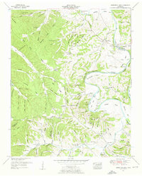
1936 Map of Nunnelly
USGS Topo · Published 1936About this map
The Centerville townsite sits at a bend of the Duck River, serving as a central hub in Hickman County during this mid-1930s survey. This era reveals a landscape defined by its mineral resources and infrastructure, including the Nunnelly Mines and Johnson Mines which speak to the industrial roots of the region. Transportation is anchored by the St Louis RR and the Nashville and Chattanooga, while the Tennessee Electric Power Company Transmission Line underscores the modernization of the Tennessee Valley.
Find a feature on this map
82 named features on this map. Tap any name to fly to it.
Don’t see what you’re looking for? This feature index may not catch every label — zoom into the map to look around manually.
Map Details
Editions of this 1936 Nunnelly Map
This is the sole edition of this map. No revisions or reprints were ever made.
Other maps of this area

1901 · Colombia
USGS Topo · 1:125,000

1936 · Beaverdam Springs
USGS Topo · 1:24,000

1936 · Whitfield
USGS Topo · 1:24,000

1936 · Sunrise
USGS Topo · 1:24,000

1936 · Littlelot
USGS Topo · 1:24,000

1936 · Texas Hollow
USGS Topo · 1:24,000

1936 · Spot
USGS Topo · 1:24,000

1936 · Greenfield Bend
USGS Topo · 1:24,000

1936 · Lyles
USGS Topo · 1:24,000
1951 · Greenfield Bend
USGS Topo · 1:24,000