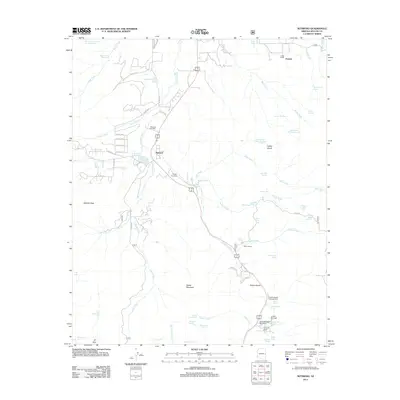
2011 Map of Nutrioso
USGS Topo · Published 2011About this map
Nutrioso serves as the central hub of this high-altitude landscape, where the headwaters of Nutrioso Creek and Auger Creek carve through the transition from ranching valleys to mountain passes. The presence of Maxwell Cemetery and Rogers Cemetery near the town site provides critical data for genealogists tracking early families in this part of Apache County. The terrain is marked by significant hydrological features such as the Nutrioso Reservoir and Rioso Reservoir, which support a network of ranching operations including Foster Ranch and the Miller Ranch. Near the southern boundary, the map documents the Alpine Divide, a notable geographic crest where the Alpine Divide Campground and Tal-Wi-Wi Lodge cater to travelers moving between the White Mountains and the San Francisco River drainage. A complex system of forest roads and county routes, including Co RD 2120 and Co RD 2010, connects isolated peaks like Gobbler Peak to the primary settlements.
Find a feature on this map
76 named features on this map. Tap any name to fly to it.
Don’t see what you’re looking for? This feature index may not catch every label — zoom into the map to look around manually.
Map Details
Editions of this 2011 Nutrioso Map
This is the sole edition of this map. No revisions or reprints were ever made.
Other maps of this area

1886 · St Johns
USGS Topo · 1:250,000

1892 · St Johns
USGS Topo · 1:250,000

1922 · Nutrioso
USGS Topo · 1:125,000

1954 · Clifton
USGS Topo · 1:250,000

1954 · Saint Johns
USGS Topo · 1:250,000

1957 · Clifton
USGS Topo · 1:250,000

1957 · Saint Johns
USGS Topo · 1:250,000

1958 · Clifton
USGS Topo · 1:250,000

1958 · Saint Johns
USGS Topo · 1:250,000

1958 · Alpine
USGS Topo · 1:62,500