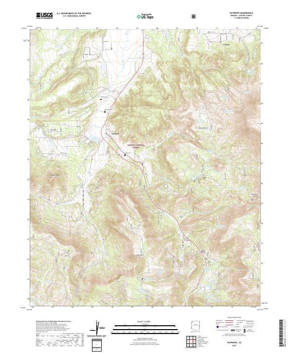
2021 Map of Nutrioso
USGS Topo · Published 2021About this map
Nutrioso serves as the central hub of this high-altitude landscape, where the valley of Nutrioso Cr meets the foothills of the Apache National Forest. The map documents a community deeply rooted in its local geography, evidenced by several family and community burial grounds including Nutrioso Cem, Rogers Cem, and Maxwell Cem. This 2021 survey illustrates a sophisticated network of water management essential for the region, featuring several reservoirs and tanks such as Nutrioso Reservoir, Riggs Cr Reservoir, and Jarvis Lake. High points like Noble Mtn and Gobbler Peak overlook the Alpine Divide, while named springs such as Whitetail Spring and Carex Spring indicate the critical water sources that have supported ranching and settlement in these mountains for generations. The layout of county roads and forest tracks reveals a landscape defined by its drainages, where Hulsey Cr and Paddy Cr carve through the timbered terrain.
Find a feature on this map
51 named features on this map. Tap any name to fly to it.
Don’t see what you’re looking for? This feature index may not catch every label — zoom into the map to look around manually.
Map Details
Editions of this 2021 Nutrioso Map
This is the sole edition of this map. No revisions or reprints were ever made.
Other maps of this area

1886 · St Johns
USGS Topo · 1:250,000

1892 · St Johns
USGS Topo · 1:250,000

1922 · Nutrioso
USGS Topo · 1:125,000

1954 · Clifton
USGS Topo · 1:250,000

1954 · Saint Johns
USGS Topo · 1:250,000

1957 · Clifton
USGS Topo · 1:250,000

1957 · Saint Johns
USGS Topo · 1:250,000

1958 · Clifton
USGS Topo · 1:250,000

1958 · Saint Johns
USGS Topo · 1:250,000

1958 · Alpine
USGS Topo · 1:62,500