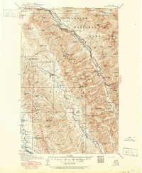
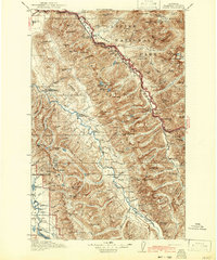
1914 Map of Nyack
USGS Topo · Published 1951About this map
Glacier National Park and the adjacent Flathead National Forest dominate this mapping of the Montana Rockies, centered on the Middle Fork Flathead River corridor. The Great Northern Railway and the Theodore Roosevelt Highway carve a vital transportation path through the mountains, connecting small outposts like Nyack PO and Walton Essex PO. The survey reveals a landscape defined by its ice and elevation, featuring the Lupfer Glacier, Stanton Glacier, and Grant Glacier along with prominent summits like Mt St Nicholas and Mt Pinchot. This edition reflects the early 20th-century administration of these lands, marking several early outposts such as the Nyack Ranger Sta and Hungry Horse Ranger Station. For researchers, the map provides a look at the primitive infrastructure of the era, including the Pioneer Ridge Trail and remote landmarks like Underwood Cabin.
Find a feature on this map
151 named features on this map. Tap any name to fly to it.
Don’t see what you’re looking for? This feature index may not catch every label — zoom into the map to look around manually.
Map Details
Editions of this 1914 Nyack Map
3 editions found
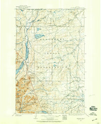
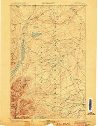
Other maps of this area
1901 · Browning
USGS Topo · 1:125,000
1903 · Browning
USGS Topo · 1:125,000

1904 · Chief Mountain
USGS Topo · 1:125,000

1906 · Kintla Lakes
USGS Topo · 1:125,000

1913 · Marias Pass
USGS Topo · 1:125,000

1914 · Nyack
USGS Topo · 1:125,000

1920 · Flathead Lake
USGS Topo · 1:125,000

1936 · Silvertip
USGS Topo · 1:96,000

1938 · Chief Mountain
USGS Topo · 1:125,000

1938 · Kintla Lakes
USGS Topo · 1:125,000