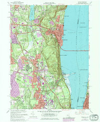
1967 Map of Nyack
USGS Topo · Published 1979About this map
Rockland State Hospital and several Catholic institutions define the mid-century landscape of Rockland County, illustrating a period of significant institutional and educational expansion. The map details the developed corridor between the Hudson River and De Forest Lake, where the newly constructed Tappan Zee Bridge and the Palisades Interstate Parkway transformed former rural townships into busy suburban centers. Along the riverfront, historic villages like Nyack and Piermont maintain their distinct identities even as urban areas, shown in purple tint, began to merge. Institutional presence is heavy throughout the quadrangle, from the U S Military Res to collegiate campuses like St Thomas Aquinas College and Dominican College. Genealogists will find notable detail in the many cemeteries, including Oak Hill Cemetery and the sprawling Rockland Cemetery near Mt Nebo.
Find a feature on this map
82 named features on this map. Tap any name to fly to it.
Don’t see what you’re looking for? This feature index may not catch every label — zoom into the map to look around manually.
Map Details
Editions of this 1967 Nyack Map
Other maps of this area

1888 · Paterson
USGS Topo · 1:62,500

1891 · Ramapo
USGS Topo · 1:62,500

1891 · Harlem
USGS Topo · 1:62,500

1892 · Paterson
USGS Topo · 1:62,500

1892 · Tarrytown
USGS Topo · 1:62,500

1893 · Tarrytown
USGS Topo · 1:62,500

1893 · Ramapo
USGS Topo · 1:62,500

1897 · Harlem
USGS Topo · 1:62,500

1898 · Harlem
USGS Topo · 1:62,500

1898 · Paterson
USGS Topo · 1:62,500