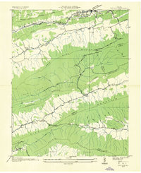
1935 Map of Nye Cove
USGS Topo · Published 1935About this map
The ridge-and-valley landscape of the Tazewell Co Bland Co border comes into sharp focus during this mid-1930s survey. Much of the northern terrain is defined by the Bluestone River and the parallel tracks of the Norfolk and Western railroad, which service the growing communities of Bluefield and the West Graham P O. Away from these transit hubs, the map reveals a rural network of small schools and houses of worship, including St Clair Sch and Ebenezer Ch, situated along the Old Fincastle Road.
Find a feature on this map
54 named features on this map. Tap any name to fly to it.
Don’t see what you’re looking for? This feature index may not catch every label — zoom into the map to look around manually.
Map Details
Editions of this 1935 Nye Cove Map
This is the sole edition of this map. No revisions or reprints were ever made.
Other maps of this area

1887 · Pocahontas
USGS Topo · 1:125,000

1891 · Pocahontas
USGS Topo · 1:125,000

1894 · Pocahontas
USGS Topo · 1:125,000

1895 · Pocahontas
USGS Topo · 1:125,000

1909 · Pocahontas Special
USGS Topo · 1:48,000

1911 · Pocahontas Special
USGS Topo · 1:62,500

1913 · Bluefield
USGS Topo · 1:48,000

1916 · Bluefield
USGS Topo · 1:62,500

1924 · Bramwell
USGS Topo · 1:62,500

1924 · Bluefield
USGS Topo · 1:62,500