2024 Map of Nyssa
USGS Topo · Published 2024About this map
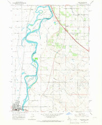
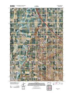
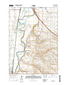
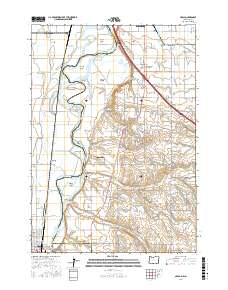
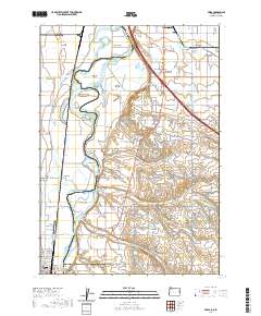
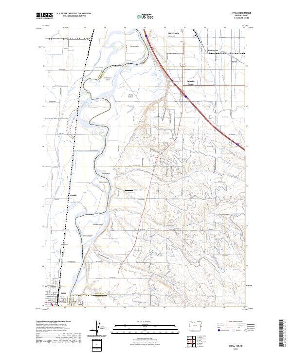
The Snake River carves a winding path through this agricultural corridor along the Oregon and Idaho border, defining the geography of both Malheur County and Payette County. The river's influence is evident in the numerous islands it has shaped, including McPhersons Island, Morton Island, and Gamble Island. The landscape is a complex network of water management, where the Farmers Cooperative Canal, Noble Canal, and Farmers Ditch support the surrounding fields like Lemons Field and Bybee Field. Significant portions of the riverbanks are protected within the Deer Flat National Wildlife Refuge. The settlement pattern follows the rail and road corridors, with Nyssa serving as a primary hub in the south and Fruitland positioned near the northern bend of the river. Small junctions and rural communities such as Arcadia and Palisades Corner dot the irrigation-dependent plains between the river and the rising gulches to the east.
Find a feature on this map
70 named features on this map. Tap any name to fly to it.
Don’t see what you’re looking for? This feature index may not catch every label — zoom into the map to look around manually.
Map Details
Editions of this 2024 Nyssa Map
This is the sole edition of this map. No revisions or reprints were ever made.
Historical Maps of Fruitland Through Time
6 maps found