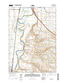
2014 Map of Nyssa
USGS Topo · Published 2014About this map
The Snake River carves a complex boundary between Oregon and Idaho on this 2014 survey, defining a landscape dominated by riparian islands and an extensive irrigation network. Large landmasses like Morton Island, McPhersons Island, and Perrin Island sit within the river's channel, while the surrounding plains are etched with vital waterways including the Farmers Cooperative Canal, A Line Canal, and Noble Canal. This area marks a significant junction of three counties—Malheur, Payette, and Canyon—centered around the communities of Nyssa and Fruitland.
Find a feature on this map
88 named features on this map. Tap any name to fly to it.
Don’t see what you’re looking for? This feature index may not catch every label — zoom into the map to look around manually.
Map Details
Editions of this 2014 Nyssa Map
This is the sole edition of this map. No revisions or reprints were ever made.
Other maps of this area

1897 · Weiser
USGS Topo · 1:125,000

1898 · Nampa
USGS Topo · 1:125,000

1906 · Mitchell Butte
USGS Topo · 1:125,000

1951 · Malheur Butte
USGS Topo · 1:24,000

1951 · Moores Hollow
USGS Topo · 1:62,500

1951 · Payette
USGS Topo · 1:24,000

1952 · Birding Island
USGS Topo · 1:24,000

1955 · Baker
USGS Topo · 1:250,000

1955 · Boise
USGS Topo · 1:250,000

1958 · Boise
USGS Topo · 1:250,000