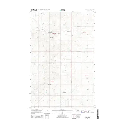
2014 Map of O'Juel Lake
USGS Topo · Published 2014About this map
Opheim Hills and the Dahl Hills define the high country of northern Valley County, Montana, in this early 21st-century record. The landscape is deeply carved by drainage features such as Deep Coulee, Furlong Coulee, and Paudois Coulee, which channel water toward the South Creek and Middle Fork Porcupine Cr. This area is characterized by large-scale ranching and remote infrastructure, evidenced by the Floyd Ranch Airport located in the northern township.
Find a feature on this map
25 named features on this map. Tap any name to fly to it.
Don’t see what you’re looking for? This feature index may not catch every label — zoom into the map to look around manually.
Map Details
Editions of this 2014 O'Juel Lake Map
This is the sole edition of this map. No revisions or reprints were ever made.
Other maps of this area
1919 · Boundary
USGS Topo · 1:125,000

1954 · Glasgow
USGS Topo · 1:250,000

1957 · Glasgow
USGS Topo · 1:250,000

1958 · Glasgow
USGS Topo · 1:250,000
1973 · Baylor
USGS Topo · 1:24,000
1973 · Opheim
USGS Topo · 1:24,000
1973 · Roanwood
USGS Topo · 1:24,000
1984 · O'Juel Lake
USGS Topo · 1:24,000
1984 · Opheim
USGS Topo · 1:100,000
1984 · Dodge Reservoir
USGS Topo · 1:24,000