
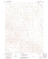
1964 Map of O'Neill SE
USGS Topo · Published 1965About this map
The S Fork Elkhorn R winds through the southern portion of this Nebraska landscape, where the township boundaries of Grattan, Inman, and Mcclure converge. Surveyed in the mid-1960s, the terrain is defined by a sparse distribution of rural infrastructure, including the Willow Lake Sch situated near its namesake, Willow Lake. The northern edge of the map is dominated by the corridor of the Chicago and North Western railroad, which historically served as a vital artery for the region's agricultural transport. In the northeastern corner, the small settlement of Stafford appears along this rail line, while the Inman Cem provides a specific point of interest for genealogists tracing family histories in Holt County. The map reflects a period of localized rural development within the Missouri River Basin project.
Find a feature on this map
9 named features on this map. Tap any name to fly to it.
Don’t see what you’re looking for? This feature index may not catch every label — zoom into the map to look around manually.
Map Details
Editions of this 1964 O'Neill SE Map
2 editions found
Other maps of this area

1955 · O'Neill
USGS Topo · 1:250,000

1958 · O'Neill
USGS Topo · 1:24,000

1958 · Inman
USGS Topo · 1:24,000

1958 · Page
USGS Topo · 1:24,000

1959 · O'Neill
USGS Topo · 1:250,000

1963 · Ewing SW
USGS Topo · 1:24,000

1963 · Deloit NW
USGS Topo · 1:24,000

1964 · O'Neill SW
USGS Topo · 1:24,000

1969 · O'Neill
USGS Topo · 1:250,000

1981 · Chambers East
USGS Topo · 1:24,000