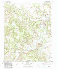
1993 Map of O V Mesa
USGS Topo · Published 1994About this map
The Purgatoire River carves a deep path through this section of Las Animas County, shaping a landscape dominated by the Comanche National Grassland and the Fort Carson Mil Res. This 1993 revision documents the coexistence of federal military training grounds and public grazing lands. The presence of the Rourke Ranch and scattered Ruins indicates the area's ranching heritage, while a small Cem and family-named landmarks like the Pamena Windmill and Mesa Windmill provide specific points of interest for genealogists tracing local lineage. The topography is defined by the massive OV Mesa and a complex network of drainages including Bent Canyon and Chacuaco Creek, accessible primarily by a network of 4WD tracks.
Find a feature on this map
32 named features on this map. Tap any name to fly to it.
Don’t see what you’re looking for? This feature index may not catch every label — zoom into the map to look around manually.
Map Details
Editions of this 1993 O V Mesa Map
This is the sole edition of this map. No revisions or reprints were ever made.
Other maps of this area

1891 · Timpas
USGS Topo · 1:125,000

1891 · Mesa De Maya
USGS Topo · 1:125,000

1893 · Mesa de Maya
USGS Topo · 1:125,000

1894 · Timpas
USGS Topo · 1:125,000

1955 · La Junta
USGS Topo · 1:250,000

1958 · La Junta
USGS Topo · 1:250,000

1968 · La Junta
USGS Topo · 1:250,000

1972 · Johnson Canyon
USGS Topo · 1:24,000

1972 · Doss Canyon North
USGS Topo · 1:24,000

1972 · Plum Canyon
USGS Topo · 1:24,000