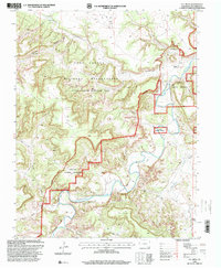
1996 Map of O V Mesa
USGS Topo · Published 2000About this map
The Purgatoire River carves a deep path through this portion of Las Animas County, shaping a landscape defined by dramatic relief and isolated landmarks. The northern half of the map is dominated by the Fort Carson Military Reservation (Piñon Canyon Maneuver Site), where the Bent Canyon and Sugarloaf rise above the surrounding terrain. This era of land management reflects a transition from early ranching to military and conservation use, as seen in the presence of the Comanche National Grassland.
Find a feature on this map
25 named features on this map. Tap any name to fly to it.
Don’t see what you’re looking for? This feature index may not catch every label — zoom into the map to look around manually.
Map Details
Editions of this 1996 O V Mesa Map
This is the sole edition of this map. No revisions or reprints were ever made.
Other maps of this area

1891 · Timpas
USGS Topo · 1:125,000

1891 · Mesa De Maya
USGS Topo · 1:125,000

1893 · Mesa de Maya
USGS Topo · 1:125,000

1894 · Timpas
USGS Topo · 1:125,000

1955 · La Junta
USGS Topo · 1:250,000

1958 · La Junta
USGS Topo · 1:250,000

1968 · La Junta
USGS Topo · 1:250,000

1972 · Johnson Canyon
USGS Topo · 1:24,000

1972 · Doss Canyon North
USGS Topo · 1:24,000

1972 · Plum Canyon
USGS Topo · 1:24,000