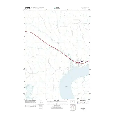
2012 Map of Oacoma
USGS Topo · Published 2012About this map
Lake Francis Case dominates the southeastern quadrant of this landscape, where the waters of the Missouri River reservoir meet the mouth of the White River. The town of Oacoma sits along the northern shoreline, its grid including streets like Main Ave and Dougan Ave, and is anchored locally by the Oacoma Cem. This area serves as a transition from the river valley to the higher ranchlands, where named properties such as Sharp Ranch and Lindly Ranch are situated among the drainages of American Crow Cr and Big Cr. To the south, the terrain shifts towards the edge of the Badlands, reflecting the varied geography of Lyman County. The presence of S Dakota Highway 16 and Interstate 90 highlights the corridor's role in transcontinental travel through South Dakota's river country.
Find a feature on this map
26 named features on this map. Tap any name to fly to it.
Don’t see what you’re looking for? This feature index may not catch every label — zoom into the map to look around manually.
Map Details
Editions of this 2012 Oacoma Map
This is the sole edition of this map. No revisions or reprints were ever made.
Other maps of this area

1935 · Chamberlain
USGS Topo · 1:62,500

1939 · Chamberlain
USGS Topo · 1:62,500

1940 · Iona
USGS Topo · 1:62,500

1944 · Iona
USGS Topo · 1:62,500

1952 · Reliance SE
USGS Topo · 1:24,000

1952 · Hamill NE
USGS Topo · 1:24,000

1952 · Oacoma
USGS Topo · 1:24,000

1952 · Iona NW
USGS Topo · 1:24,000

1955 · Mitchell
USGS Topo · 1:250,000

1959 · Mitchell
USGS Topo · 1:250,000