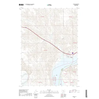
2017 Map of Oacoma
USGS Topo · Published 2017About this map
The town of Oacoma sits at a historic crossroads where the prairie meets the high bluffs overlooking the Missouri River. This 2017 study illustrates the modern geography of the western bank, showing the expansive Lake Francis Case reservoir and the confluence of the White River to the south. The landscape is defined by the deep drainage of American Crow Creek and its northern fork, which carve through the high ground towards the river valley. Local history is anchored by sites like Oacoma Cemetery and Moeller Cemetery, while roads such as Cooper School Rd and Ridge Rd trace the path of earlier rural development. The presence of Bice Island and Bird Island within the river channel provides a glimpse into the shifting silts and sandbars of this storied waterway, captured in detail just as the contemporary road network, including the path of Hwy 16, integrates with the older township lines.
Find a feature on this map
30 named features on this map. Tap any name to fly to it.
Don’t see what you’re looking for? This feature index may not catch every label — zoom into the map to look around manually.
Map Details
Editions of this 2017 Oacoma Map
This is the sole edition of this map. No revisions or reprints were ever made.
Other maps of this area

1935 · Chamberlain
USGS Topo · 1:62,500

1939 · Chamberlain
USGS Topo · 1:62,500

1940 · Iona
USGS Topo · 1:62,500

1944 · Iona
USGS Topo · 1:62,500

1952 · Reliance SE
USGS Topo · 1:24,000

1952 · Hamill NE
USGS Topo · 1:24,000

1952 · Oacoma
USGS Topo · 1:24,000

1952 · Iona NW
USGS Topo · 1:24,000

1955 · Mitchell
USGS Topo · 1:250,000

1959 · Mitchell
USGS Topo · 1:250,000