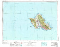
1970 Map of Oahu
USGS Topo · Published 1973About this map
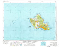
Oahu is depicted here during a period of significant post-war expansion and military prominence. The urban core of Honolulu anchors the southeastern coast, while newer residential developments like Mililani Town and Pacific Palisades indicate the island's inland growth. The landscape is defined by the volcanic topography of the Koolau Range and the Waianae Mountains, which separate the coastal plains.
Find a feature on this map
113 named features on this map. Tap any name to fly to it.
Don’t see what you’re looking for? This feature index may not catch every label — zoom into the map to look around manually.
Map Details
Editions of this 1970 Oahu Map
2 editions found
Other maps of this area

1952 · Waimea
USGS Topo · 1:24,000

1952 · Koko Head
USGS Topo · 1:24,000

1952 · Mokapu
USGS Topo · 1:24,000

1953 · Haleiwa
USGS Topo · 1:24,000

1953 · Schofield Barracks
USGS Topo · 1:24,000

1953 · Honolulu
USGS Topo · 1:24,000

1953 · Ewa
USGS Topo · 1:24,000

1953 · Puuloa
USGS Topo · 1:24,000

1953 · Hauula
USGS Topo · 1:24,000

1954 · Oahu
USGS Topo · 1:250,000