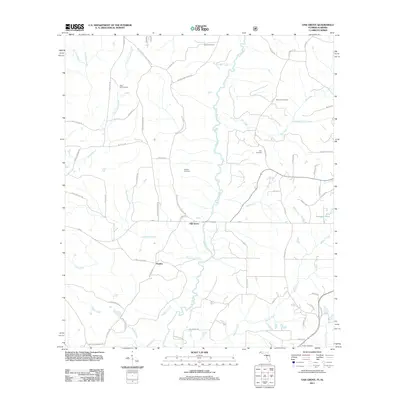
2011 Map of Oak Grove
USGS Topo · Published 2011About this map
The Yellow River flows southward through this corner of the Florida panhandle, anchoring a rural landscape defined by creek drainage and small family settlements. Near the center of the sheet, the village of Oak Grove sits at the junction of Hwy-2 and Old River Rd, while the community of Peaden lies further south. The land is heavily partitioned by local branches and creeks, including the evocative Murder Creek and Big Horse Creek. For family historians, the abundance of well-marked burial grounds provides significant research value, with Newell Cemetery, Rock Hill Cemetery, Stewart Cemetery, Clary Cemetery, Ebenezer Cemetery, and Reeder Cemetery all scattered throughout the quadrant. This area, just south of the Alabama border, remains characterized by its network of named local roads like Yellow River Baptist Church Rd and Moores Mill Creek Rd, which suggest the historic locations of early gathering places and industry.
Find a feature on this map
65 named features on this map. Tap any name to fly to it.
Don’t see what you’re looking for? This feature index may not catch every label — zoom into the map to look around manually.
Map Details
Editions of this 2011 Oak Grove Map
This is the sole edition of this map. No revisions or reprints were ever made.
Other maps of this area

1949 · Crestview
USGS Topo · 1:62,500

1949 · Laurel Hill
USGS Topo · 1:62,500

1950 · Laurel Hill
USGS Topo · 1:62,500

1951 · Crestview
USGS Topo · 1:62,500

1953 · Andalusia
USGS Topo · 1:250,000

1957 · Andalusia
USGS Topo · 1:250,000

1957 · Pensacola
USGS Topo · 1:250,000

1959 · Pensacola
USGS Topo · 1:250,000

1960 · Pensacola
USGS Topo · 1:250,000

1971 · Bradley
USGS Topo · 1:24,000