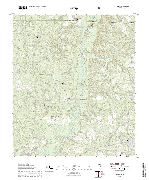
2024 Map of Oak Grove
USGS Topo · Published 2024About this map
The Yellow River cuts a wide, meandering path through this landscape along the border of Florida and Alabama, defining the geography of Oak Grove and the surrounding rural communities. This area is heavily forested, with the northern portion extending into the Conecuh National Forest. The map reveals a high density of small, family or community burial grounds that point to the deep-rooted genealogical history of northern Okaloosa County. These include sites such as the New Ebenezer Cem, Rock Hill Cem, and Magnolia Cem.
Find a feature on this map
90 named features on this map. Tap any name to fly to it.
Don’t see what you’re looking for? This feature index may not catch every label — zoom into the map to look around manually.
Map Details
Editions of this 2024 Oak Grove Map
This is the sole edition of this map. No revisions or reprints were ever made.
Other maps of this area

1949 · Crestview
USGS Topo · 1:62,500

1949 · Laurel Hill
USGS Topo · 1:62,500

1950 · Laurel Hill
USGS Topo · 1:62,500

1951 · Crestview
USGS Topo · 1:62,500

1953 · Andalusia
USGS Topo · 1:250,000

1957 · Andalusia
USGS Topo · 1:250,000

1957 · Pensacola
USGS Topo · 1:250,000

1959 · Pensacola
USGS Topo · 1:250,000

1960 · Pensacola
USGS Topo · 1:250,000

1971 · Bradley
USGS Topo · 1:24,000