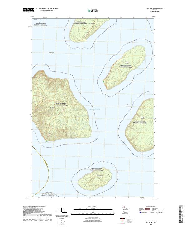
2022 Map of Oak Island
USGS Topo · Published 2022About this map
Apostle Islands National Lakeshore preserves a distinctive archipelago within the cold waters of Lake Superior, where land and water meet along the border of Ashland and Bayfield counties. The central feature is Oak Island, marked by its significant elevation and a network of footpaths including the Oak Island Trl. To the east, the map reveals the western portions of Manitou Island and Stockton Island, the latter featuring the prominent Quarry Point along its southwestern shore. This survey details the bathymetry and navigational hazards of the West Channel, identifying the submerged Oak Island Shoal and the steep coastal features of the Clay Banks. The isolation of Hermit Island and Otter Island highlights the remote nature of these islands, which are largely defined by their rugged topography and lack of modern road infrastructure, relying instead on established trails like the Otter Island Trl and Manitou Island Trl.
Find a feature on this map
21 named features on this map. Tap any name to fly to it.
Don’t see what you’re looking for? This feature index may not catch every label — zoom into the map to look around manually.
Map Details
Editions of this 2022 Oak Island Map
This is the sole edition of this map. No revisions or reprints were ever made.
Other maps of this area

1941 · Bayfield
USGS Topo · 1:48,000

1946 · Bayfield
USGS Topo · 1:48,000

1953 · Ashland
USGS Topo · 1:250,000

1954 · Two Harbors
USGS Topo · 1:250,000

1957 · Two Harbors
USGS Topo · 1:250,000

1958 · Ashland
USGS Topo · 1:250,000

1958 · Two Harbors
USGS Topo · 1:250,000

1963 · Cat Island
USGS Topo · 1:24,000

1963 · Rocky Island
USGS Topo · 1:62,500

1963 · Oak Island
USGS Topo · 1:24,000