
1963 Map of Oak Island
USGS Topo · Published 1965About this map
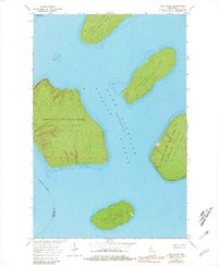
Apostle Islands rise from the cold waters of Lake Superior in this early 1960s survey, documenting the archipelago's terrain before it became a national lakeshore. The map focuses on the central islands of La Pointe Twp, including the prominent elevations of Oak Island and the neighboring Manitou Island. Evidence of the region's industrial past is visible at Quarry Point on Stockton Island and another Quarry on Hermit Island, where the famous brownstone was once extracted for urban construction. While much of the land is preserved within the Apostle Islands State Forest, small maritime markers like a Light off Manitou and the treacherous Oak Island Shoal highlight the area's continued importance for navigation. The map also delineates the Bayfield Co Ashland Co boundary as it cuts through these northern waters.
Find a feature on this map
16 named features on this map. Tap any name to fly to it.
Don’t see what you’re looking for? This feature index may not catch every label — zoom into the map to look around manually.
Map Details
Editions of this 1963 Oak Island Map
2 editions found
Other maps of this area

1941 · Bayfield
USGS Topo · 1:48,000

1946 · Bayfield
USGS Topo · 1:48,000

1953 · Ashland
USGS Topo · 1:250,000

1954 · Two Harbors
USGS Topo · 1:250,000

1957 · Two Harbors
USGS Topo · 1:250,000

1958 · Ashland
USGS Topo · 1:250,000

1958 · Two Harbors
USGS Topo · 1:250,000

1963 · Cat Island
USGS Topo · 1:24,000

1963 · Rocky Island
USGS Topo · 1:62,500
1963 · Stockton Island
USGS Topo · 1:24,000