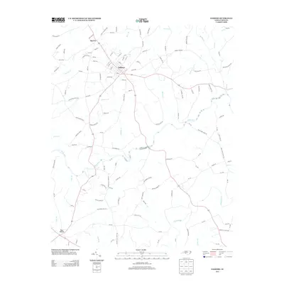
2013 Map of Oakboro
USGS Topo · Published 2013About this map
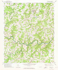
Oakboro serves as the central hub of this Stanly County landscape, where a dense grid of streets like Pine St and Hamilton Rd transitions into a network of rural routes and watercourses. The area is defined by the winding path of the Rocky River, which collects numerous tributaries including Richardson Cr, Coldwater Br, and Gilberts Cr. To the northwest, the settlement of Big Lick is situated near the headwaters of Cucumber Cr, while New Salem anchors the southwestern corner of the survey. The naming conventions of the local road system, such as Philadelphia Church Rd, Mineral Springs Rd, and Ledbetter Ford Rd, suggest a history rooted in early congregation points, natural springs, and historic river crossings that shaped the settlement patterns of the region.
Find a feature on this map
113 named features on this map. Tap any name to fly to it.
Don’t see what you’re looking for? This feature index may not catch every label — zoom into the map to look around manually.
Map Details
Editions of this 2013 Oakboro Map
This is the sole edition of this map. No revisions or reprints were ever made.
Other maps of this area

1953 · Charlotte
USGS Topo · 1:250,000

1954 · Charlotte
USGS Topo · 1:250,000

1957 · Mount Pleasant
USGS Topo · 1:62,500

1957 · Albemarle
USGS Topo · 1:62,500

1960 · Charlotte
USGS Topo · 1:250,000

1962 · Charlotte
USGS Topo · 1:250,000
1970 · Watson
USGS Topo · 1:24,000
1970 · Polkton
USGS Topo · 1:24,000
1970 · Olive Branch
USGS Topo · 1:24,000
1971 · Stanfield
USGS Topo · 1:24,000