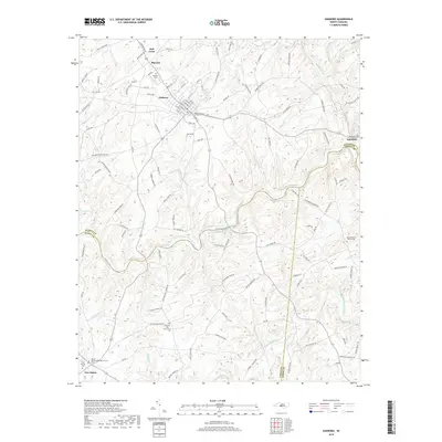
2019 Map of Oakboro
USGS Topo · Published 2019About this map
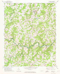
The town of Oakboro and its surrounding rural communities are situated at a unique geographic crossroads where Stanly, Union, and Anson counties meet. This area, documented in the 21st century, maintains a landscape defined by its historical settlements and a dense network of local tributaries including Big Bear Creek and Richardson Creek. The map reveals the community-focused layout of the Piedmont, where centers like Big Lick and Red Cross are connected by a web of local roads such as Hatley-Burris Rd and Barbees Grove Rd. For those researching local lineages, the abundance of rural burial sites—such as Oakboro Cem, Rocky Mount Church Cem, and Euto Cem—alongside longstanding houses of worship like Philadelphia Church and Mount Moriah Methodist Church, provides a clear view of the area's established social and religious geography.
Find a feature on this map
126 named features on this map. Tap any name to fly to it.
Don’t see what you’re looking for? This feature index may not catch every label — zoom into the map to look around manually.
Map Details
Editions of this 2019 Oakboro Map
This is the sole edition of this map. No revisions or reprints were ever made.
Other maps of this area

1953 · Charlotte
USGS Topo · 1:250,000

1954 · Charlotte
USGS Topo · 1:250,000

1957 · Mount Pleasant
USGS Topo · 1:62,500

1957 · Albemarle
USGS Topo · 1:62,500

1960 · Charlotte
USGS Topo · 1:250,000

1962 · Charlotte
USGS Topo · 1:250,000
1970 · Watson
USGS Topo · 1:24,000
1970 · Polkton
USGS Topo · 1:24,000
1970 · Olive Branch
USGS Topo · 1:24,000
1971 · Stanfield
USGS Topo · 1:24,000