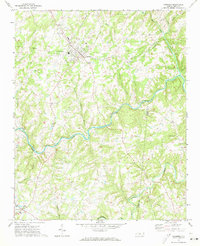
1971 Map of Oakboro
USGS Topo · Published 1973About this map
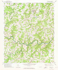
Oakboro serves as the central hub of this 1970s survey, situated along the Norfolk Southern railway line at a time when the town's footprint was defined by its proximity to the tracks and the surrounding agricultural landscape. The terrain is characterized by the winding path of the Rocky River, which marks the boundary between Stanly and Union Counties, and the convergence of several smaller waterways including Big Bear Creek and Richardson Creek.
Find a feature on this map
37 named features on this map. Tap any name to fly to it.
Don’t see what you’re looking for? This feature index may not catch every label — zoom into the map to look around manually.
Map Details
Editions of this 1971 Oakboro Map
This is the sole edition of this map. No revisions or reprints were ever made.
Other maps of this area

1953 · Charlotte
USGS Topo · 1:250,000

1954 · Charlotte
USGS Topo · 1:250,000

1957 · Mount Pleasant
USGS Topo · 1:62,500

1957 · Albemarle
USGS Topo · 1:62,500

1960 · Charlotte
USGS Topo · 1:250,000

1962 · Charlotte
USGS Topo · 1:250,000
1970 · Watson
USGS Topo · 1:24,000
1970 · Polkton
USGS Topo · 1:24,000
1970 · Olive Branch
USGS Topo · 1:24,000
1971 · Stanfield
USGS Topo · 1:24,000