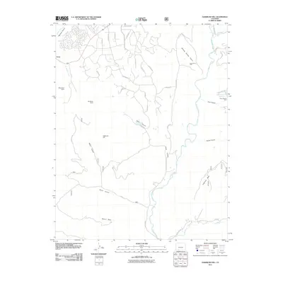
2011 Map of Oakbrush Hill
USGS Topo · Published 2011About this map
The San Juan River and Rio Blanco converge in this Colorado landscape, shaping a terrain of prominent mesas and deep canyons south of Pagosa Springs. The map documents a period of residential expansion characterized by a network of winding roads like Vista San Juan and S Pagosa Blvd, contrasting with the more traditional land use of the Seavy Ranch Mine found near Stinking Springs Canyon. Water management is a central theme, evidenced by the Echo Canyon Reservoir and its associated Echo Canyon Dam in the northeast. This 2011 survey captures the intersection of natural landmarks like Eightmile Mesa and Oakbrush Hill with modern subdivision development, providing a clear record of how this portion of Archuleta County has transitioned between ranching roots and mountain residential growth.
Find a feature on this map
43 named features on this map. Tap any name to fly to it.
Don’t see what you’re looking for? This feature index may not catch every label — zoom into the map to look around manually.
Map Details
Editions of this 2011 Oakbrush Hill Map
This is the sole edition of this map. No revisions or reprints were ever made.
Other maps of this area

1913 · Summitville
USGS Topo · 1:125,000

1915 · Summitville
USGS Topo · 1:125,000

1924 · Pagosa Springs
USGS Topo · 1:125,000

1927 · Pagosa Springs
USGS Topo · 1:125,000

1945 · Durango
USGS Topo · 1:250,000

1953 · Durango
USGS Topo · 1:250,000

1954 · Durango
USGS Topo · 1:250,000

1957 · Chromo
USGS Topo · 1:62,500

1957 · Wolf Creek Pass
USGS Topo · 1:62,500

1957 · Pagosa Junction
USGS Topo · 1:62,500