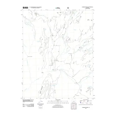
2011 Map of Oakbrush Ridge
USGS Topo · Published 2011About this map
Debs Community Hall stands as a focal point for the isolated mountain communities within this portion of the San Juan Mountains in the early twenty-first century. The landscape is defined by the complex drainage systems of the Piedra River, including its Middle and East Forks, which have dictated the placement of early infrastructure like the Toner-Taylor Ditch and Piedra Falls Ditch. High-altitude water management is evident at Trail Ridge Reservoir and Spring Creek Reservoir, supporting both the local ranching economy and recreation.
Find a feature on this map
63 named features on this map. Tap any name to fly to it.
Don’t see what you’re looking for? This feature index may not catch every label — zoom into the map to look around manually.
Map Details
Editions of this 2011 Oakbrush Ridge Map
This is the sole edition of this map. No revisions or reprints were ever made.
Other maps of this area

1905 · San Cristobal
USGS Topo · 1:125,000

1907 · San Cristobal
USGS Topo · 1:125,000

1924 · Pagosa Springs
USGS Topo · 1:125,000

1927 · Pagosa Springs
USGS Topo · 1:125,000

1945 · Durango
USGS Topo · 1:250,000

1953 · Durango
USGS Topo · 1:250,000

1954 · Durango
USGS Topo · 1:250,000

1961 · Durango
USGS Topo · 1:250,000

1963 · Durango
USGS Topo · 1:250,000
1964 · Chris Mountain
USGS Topo · 1:24,000