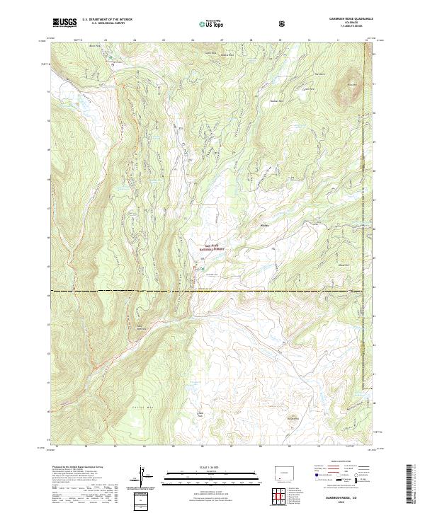
2022 Map of Oakbrush Ridge
USGS Topo · Published 2022About this map
San Juan National Forest defines the character of this mountain landscape, where the Middle Fork Piedra River and E Fork Piedra River converge. The topography is marked by significant vertical relief, from the heights of Oakbrush Ridge and Rock Mtn down into the Weminuche Valley. This 2022 survey captures the intricate network of pack trails and forest roads that facilitate movement through the high country, including the Piedra Stock Dr Trl and various routes traversing Ice Cave Ridge. The presence of the Piedra Falls Ditch and Trail Ridge Reservoir suggests a managed water system designed to direct flow from these alpine drainages. Scattered points of interest like Sally Overlook and landmarks such as The Ant Hill provide specific navigational anchors within the expansive forest boundaries.
Find a feature on this map
109 named features on this map. Tap any name to fly to it.
Don’t see what you’re looking for? This feature index may not catch every label — zoom into the map to look around manually.
Map Details
Editions of this 2022 Oakbrush Ridge Map
This is the sole edition of this map. No revisions or reprints were ever made.
Other maps of this area

1905 · San Cristobal
USGS Topo · 1:125,000

1907 · San Cristobal
USGS Topo · 1:125,000

1924 · Pagosa Springs
USGS Topo · 1:125,000

1927 · Pagosa Springs
USGS Topo · 1:125,000

1945 · Durango
USGS Topo · 1:250,000

1953 · Durango
USGS Topo · 1:250,000

1954 · Durango
USGS Topo · 1:250,000

1961 · Durango
USGS Topo · 1:250,000

1963 · Durango
USGS Topo · 1:250,000
1964 · Chris Mountain
USGS Topo · 1:24,000