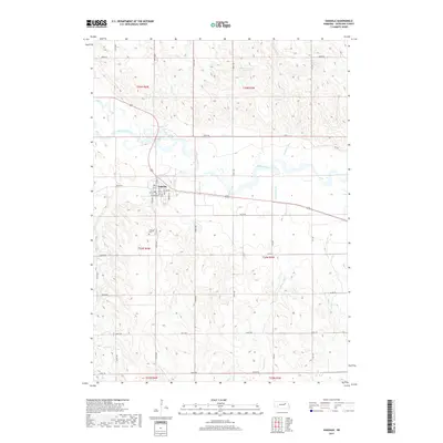
2017 Map of Oakdale
USGS Topo · Published 2017About this map
Oakdale serves as the central hub of this Antelope County landscape, situated on the southern banks of the Elkhorn River. The town's grid is well-defined by residential streets such as Hohman St, Lawton Ave, and Greeley St. South of the main settlement lies the Oakdale Cem, a point of interest for genealogists tracing local families in this portion of Nebraska. The surrounding terrain is characterized by a dense network of drainage systems, including Trueblood Cr, Saint Clair Cr, and Ives Cr, which feed into the larger river valley. To the north, the Mitchell-Brandt Reservoir provides a notable water feature amidst the agricultural sections of T25N R5W. The map documents a highly structured rural landscape defined by an extensive system of county roads, including 844th Rd and 527th Ave, illustrating the enduring section-line organization of the region.
Find a feature on this map
39 named features on this map. Tap any name to fly to it.
Don’t see what you’re looking for? This feature index may not catch every label — zoom into the map to look around manually.
Map Details
Editions of this 2017 Oakdale Map
This is the sole edition of this map. No revisions or reprints were ever made.
Other maps of this area

1955 · Broken Bow
USGS Topo · 1:250,000

1955 · Sioux City
USGS Topo · 1:250,000

1955 · Fremont
USGS Topo · 1:250,000

1955 · O'Neill
USGS Topo · 1:250,000

1956 · Broken Bow
USGS Topo · 1:250,000

1957 · Fremont
USGS Topo · 1:250,000

1958 · Sioux City
USGS Topo · 1:250,000

1958 · Fremont
USGS Topo · 1:250,000

1959 · O'Neill
USGS Topo · 1:250,000

1959 · Sioux City
USGS Topo · 1:250,000