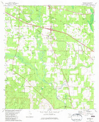
1982 Map of Oakdale
USGS Topo · Published 1982About this map
The Chipola River anchors this central Florida landscape, winding through a network of creeks and wetlands south of the Marianna area. Scattered settlements and community hubs like Oakdale and Simsville are defined by their small rural institutions, including Marvin Ch and the Hope Sch. The map reveals a high concentration of small family and community burial grounds, such as Pledger Cem, Grant Cem, and Lipford Cem, which provide significant value for tracing local lineage in this part of Jackson County.
Find a feature on this map
43 named features on this map. Tap any name to fly to it.
Don’t see what you’re looking for? This feature index may not catch every label — zoom into the map to look around manually.
Map Details
Editions of this 1982 Oakdale Map
This is the sole edition of this map. No revisions or reprints were ever made.
Other maps of this area

1952 · Cypress
USGS Topo · 1:24,000

1952 · Oakdale
USGS Topo · 1:24,000

1952 · Kynesville
USGS Topo · 1:24,000

1952 · Dellwood
USGS Topo · 1:24,000

1952 · Alford SE
USGS Topo · 1:24,000

1952 · Altha West
USGS Topo · 1:24,000

1952 · Cottondale East
USGS Topo · 1:24,000

1952 · Altha East
USGS Topo · 1:24,000

1952 · Marianna
USGS Topo · 1:24,000

1954 · Tallahassee
USGS Topo · 1:250,000