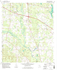
1994 Map of Oakdale
USGS Topo · Published 1998About this map
The Chipola River winds through the heart of this Jackson County landscape, its course flanked by a dense network of springs and branches including Spring Creek and Buck Pelt Branch. This 1990s-era record reflects a rural community anchored by small settlements like Oakdale and Simsville, where the legacy of early families is preserved in numerous burial grounds such as Jerusalem Cem, Pledger Cem, and Braxton Cem.
Find a feature on this map
39 named features on this map. Tap any name to fly to it.
Don’t see what you’re looking for? This feature index may not catch every label — zoom into the map to look around manually.
Map Details
Editions of this 1994 Oakdale Map
This is the sole edition of this map. No revisions or reprints were ever made.
Other maps of this area

1952 · Cypress
USGS Topo · 1:24,000

1952 · Oakdale
USGS Topo · 1:24,000

1952 · Kynesville
USGS Topo · 1:24,000

1952 · Dellwood
USGS Topo · 1:24,000

1952 · Alford SE
USGS Topo · 1:24,000

1952 · Altha West
USGS Topo · 1:24,000

1952 · Cottondale East
USGS Topo · 1:24,000

1952 · Altha East
USGS Topo · 1:24,000

1952 · Marianna
USGS Topo · 1:24,000

1954 · Tallahassee
USGS Topo · 1:250,000