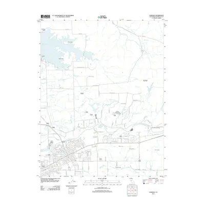
2012 Map of Oakdale
USGS Topo · Published 2012About this map
Woodward Reservoir dominates the northwest corner of this landscape, its shoreline defined by distinct features like Biscuit Point, T Island, and Whale Island. This 2012 map illustrates the intricate water management system essential to the Central Valley, featuring an extensive network of canals and laterals including the San Joaquin Main Canal, the Oakdale North Main Canal, and the Oakdale South Main Canal. This infrastructure supports agricultural operations such as the Hoekstra Dairy and U-3 Ranch.
Find a feature on this map
159 named features on this map. Tap any name to fly to it.
Don’t see what you’re looking for? This feature index may not catch every label — zoom into the map to look around manually.
Map Details
Editions of this 2012 Oakdale Map
This is the sole edition of this map. No revisions or reprints were ever made.
Other maps of this area

1915 · Oakdale
USGS Topo · 1:31,680

1915 · Trigo
USGS Topo · 1:31,680

1915 · Paulsell
USGS Topo · 1:31,680

1915 · Thalheim
USGS Topo · 1:31,680

1916 · Riverbank
USGS Topo · 1:31,680

1916 · Waterford
USGS Topo · 1:31,680

1916 · Bachelor Valley
USGS Topo · 1:31,680

1916 · Copperopolis
USGS Topo · 1:62,500

1939 · Modesto East
USGS Topo · 1:62,500

1942 · Farmington
USGS Topo · 1:62,500