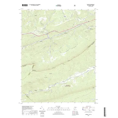
2019 Map of Oakvale
USGS Topo · Published 2019About this map
Oakvale and the surrounding Mercer County landscape are defined by the winding course of the East River, where modern transportation corridors follow the same natural passages used for generations. This 2019 survey captures the community structure near the West Virginia and Virginia border, anchored by settlements like Kellysville and Willowton. The map reveals a high density of family and community history sites, including the Oakvale Cem, Hales Chapel Cem, and Beamer Cem, which serve as vital markers for genealogical research in this Appalachian corridor.
Find a feature on this map
65 named features on this map. Tap any name to fly to it.
Don’t see what you’re looking for? This feature index may not catch every label — zoom into the map to look around manually.
Map Details
Editions of this 2019 Oakvale Map
This is the sole edition of this map. No revisions or reprints were ever made.
Other maps of this area

1887 · Pocahontas
USGS Topo · 1:125,000

1890 · Dublin
USGS Topo · 1:125,000

1891 · Pocahontas
USGS Topo · 1:125,000

1891 · Dublin
USGS Topo · 1:125,000

1894 · Pocahontas
USGS Topo · 1:125,000

1895 · Pocahontas
USGS Topo · 1:125,000

1913 · Peterstown
USGS Topo · 1:48,000

1913 · Bluefield
USGS Topo · 1:48,000

1916 · Bluefield
USGS Topo · 1:62,500

1916 · Peterstown
USGS Topo · 1:62,500