
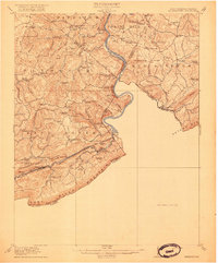
1916 Map of Peterstown
USGS Topo · Published 1916About this map
Peters Mountain and East River Mountain dominate this corner of the Virginias, where the border between the two states winds through the high ridges. The New River cuts a deep path across the terrain, navigated at this time by Shanklins Ferry and flanked by industrial developments like the Mauvern Saltworks. To the south, the Norfolk and Western and Virginian railroads run parallel along the East River valley, facilitating movement through the Hales Gap Tunnel.
Find a feature on this map
105 named features on this map. Tap any name to fly to it.
Don’t see what you’re looking for? This feature index may not catch every label — zoom into the map to look around manually.
Map Details
Editions of this 1916 Peterstown Map
2 editions found
Other maps of this area

1887 · Pocahontas
USGS Topo · 1:125,000

1887 · Hinton
USGS Topo · 1:125,000

1890 · Dublin
USGS Topo · 1:125,000

1891 · Pocahontas
USGS Topo · 1:125,000

1891 · Dublin
USGS Topo · 1:125,000

1891 · Raleigh
USGS Topo · 1:125,000

1892 · Hinton
USGS Topo · 1:125,000

1894 · Pocahontas
USGS Topo · 1:125,000

1895 · Pocahontas
USGS Topo · 1:125,000

1897 · Raleigh
USGS Topo · 1:125,000