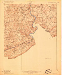
1916 Map of Peterstown
USGS Topo · Published 1916About this map
Mercers Saltworks and the winding course of the New River anchor this 1913 survey of the borderlands between West Virginia and Virginia. The landscape is defined by the sharp ridges of Peters Mtn and Christian Ridge, where small mountain communities relied on a dense network of local schools like Scratchgravel School, Possum Hollow School, and Mudhole School. The southern portion of the map reveals the industrial footprint of the Norfolk and Western Ry and Virginian Ry, which follow the East River through Oakvale and Kellysville.
Find a feature on this map
95 named features on this map. Tap any name to fly to it.
Don’t see what you’re looking for? This feature index may not catch every label — zoom into the map to look around manually.
Map Details
Editions of this 1916 Peterstown Map
2 editions found

Other maps of this area

1887 · Pocahontas
USGS Topo · 1:125,000

1887 · Hinton
USGS Topo · 1:125,000

1890 · Dublin
USGS Topo · 1:125,000

1891 · Pocahontas
USGS Topo · 1:125,000

1891 · Dublin
USGS Topo · 1:125,000

1891 · Raleigh
USGS Topo · 1:125,000

1892 · Hinton
USGS Topo · 1:125,000

1894 · Pocahontas
USGS Topo · 1:125,000

1895 · Pocahontas
USGS Topo · 1:125,000

1897 · Raleigh
USGS Topo · 1:125,000