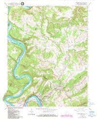
1965 Map of Peterstown
USGS Topo · Published 1984About this map
Peterstown serves as a focal point in this survey of the borderlands between Monroe County, West Virginia, and Giles County, Virginia. The landscape is defined by the deep winding path of the New River, which flows past settlements like Lurich and Glen Lyn while filling the Bluestone Lake reservoir. The presence of the Norfolk and Western railway along the riverbank underscores the region's historic role as a transportation corridor through the Appalachian ridges.
Find a feature on this map
48 named features on this map. Tap any name to fly to it.
Don’t see what you’re looking for? This feature index may not catch every label — zoom into the map to look around manually.
Map Details
Editions of this 1965 Peterstown Map
Other maps of this area

1887 · Hinton
USGS Topo · 1:125,000

1890 · Dublin
USGS Topo · 1:125,000

1891 · Dublin
USGS Topo · 1:125,000

1892 · Hinton
USGS Topo · 1:125,000

1912 · Big Bend
USGS Topo · 1:62,500

1913 · Peterstown
USGS Topo · 1:48,000

1914 · Big Bend
USGS Topo · 1:62,500

1916 · Peterstown
USGS Topo · 1:62,500

1921 · Alderson
USGS Topo · 1:48,000

1923 · Pearisburg
USGS Topo · 1:62,500