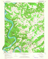
1965 Map of Peterstown
USGS Topo · Published 1966About this map
Peterstown sits at the southern edge of this survey near the state line, where Rich Creek flows toward the New River. The mid-1960s landscape is defined by the significant reach of the Bluestone Reservoir backing up into the valley along Pipestem, creating a massive water body where the river once wound through narrow gaps. Evidence of the region’s older rural community structure remains visible through small hilltop settlements like Ballard and Cashmere, and isolated meeting points such as Thompson Chapel and Midway Ch.
Find a feature on this map
52 named features on this map. Tap any name to fly to it.
Don’t see what you’re looking for? This feature index may not catch every label — zoom into the map to look around manually.
Map Details
Editions of this 1965 Peterstown Map
Other maps of this area

1887 · Hinton
USGS Topo · 1:125,000

1890 · Dublin
USGS Topo · 1:125,000

1891 · Dublin
USGS Topo · 1:125,000

1892 · Hinton
USGS Topo · 1:125,000

1912 · Big Bend
USGS Topo · 1:62,500

1913 · Peterstown
USGS Topo · 1:48,000

1914 · Big Bend
USGS Topo · 1:62,500

1916 · Peterstown
USGS Topo · 1:62,500

1921 · Alderson
USGS Topo · 1:48,000

1923 · Pearisburg
USGS Topo · 1:62,500